District Overview

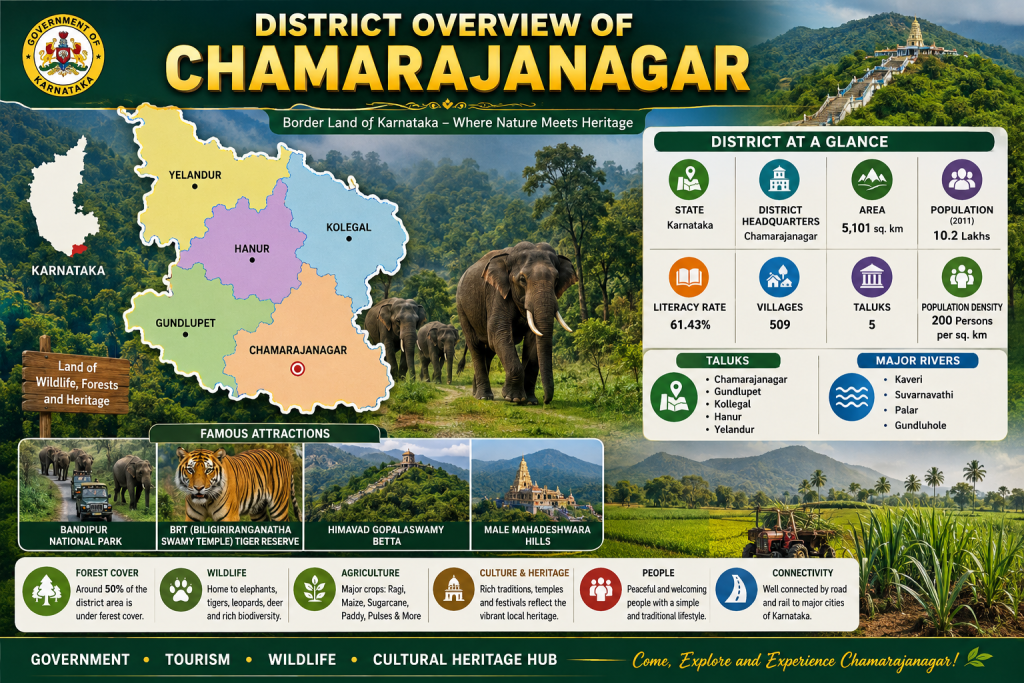
Chamarajanagar district, located in the southern part of Karnataka, is renowned for its rich natural heritage, diverse wildlife, scenic landscapes, and cultural significance. The district is home to famous attractions such as Bandipur National Park, BRT Tiger Reserve, Himavad Gopalaswamy Betta, and Male Mahadeshwara Hills, making it a major destination for nature lovers and pilgrims alike. With nearly half of its geographical area covered by forests, Chamarajanagar supports a thriving ecosystem that includes elephants, tigers, leopards, and numerous other species. Agriculture remains a key economic activity, with crops such as ragi, maize, sugarcane, paddy, and pulses widely cultivated across the district. The region is divided into five taluks—Chamarajanagar, Gundlupet, Kollegal, Hanur, and Yelandur-and is enriched by rivers including the Kaveri and Suvarnavathi. Blending natural beauty, cultural traditions, wildlife conservation, and rural development, Chamarajanagar stands as one of Karnataka’s most unique and environmentally significant districts.
Major Towns of Chamarajanagar District
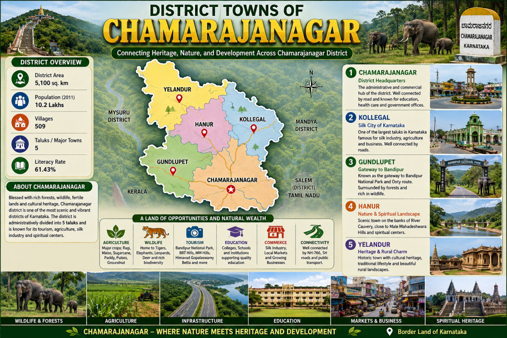
The major towns of Chamarajanagar district and highlights their importance in the region’s overall development, culture, and economy. Chamarajanagar, the district headquarters, serves as the administrative and commercial center, while Kollegal is known for its thriving silk industry and agricultural activities. Gundlupet acts as a gateway to the famous Bandipur National Park and attracts tourists traveling towards Ooty. Hanur is renowned for its scenic landscapes, spiritual significance, and proximity to the Male Mahadeshwara Hills, whereas Yelandur is admired for its rich cultural heritage and peaceful rural environment. Surrounded by forests, wildlife reserves, fertile farmlands, and well-connected road networks, these towns collectively contribute to the district’s growth in tourism, agriculture, education, trade, and conservation. Together, they reflect the unique blend of nature, heritage, and development that makes Chamarajanagar one of Karnataka’s most distinctive districts.
Population at a Glance
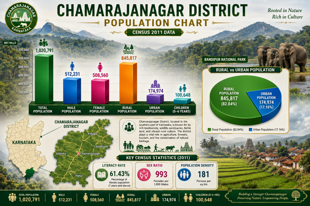
According to the Census 2011 data, Chamarajanagar District had a total population of 1,020,791, comprising 512,231 males and 508,560 females. The district has a predominantly rural population, with 845,817 people (82.84%) living in rural areas and 174,974 people (17.16%) residing in urban areas. Children aged 0–6 years accounted for 100,648 of the population. The district recorded a literacy rate of 61.43%, a sex ratio of 993 females per 1,000 males, and a population density of 181 persons per sq. km. These figures highlight Chamarajanagar’s predominantly rural character and provide an important demographic overview for understanding its people, settlements, and development needs.The predominantly rural population plays an important role in the district’s agricultural and local economy. Farming, livestock, forestry-related activities, and traditional livelihoods contribute to the social and economic character of the region. At the same time, urban centres support education, healthcare, trade, transportation, and other essential services for surrounding communities.
Geographical Area of Chamarajanagar District
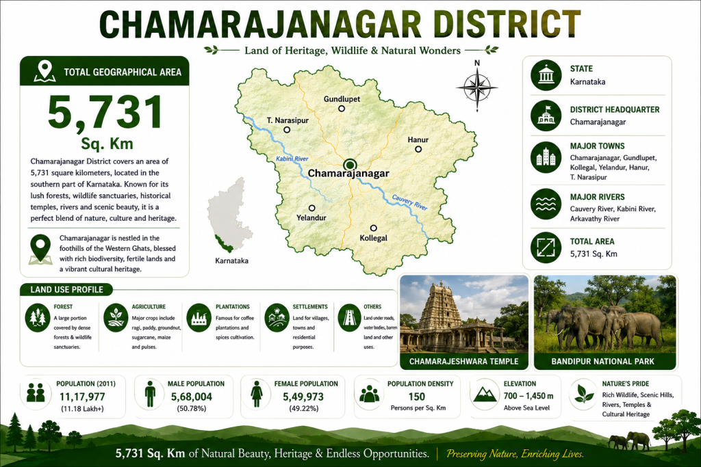
Chamarajanagar district covers a vast geographical area of approximately 5,101 square kilometers, making it one of the most ecologically rich and naturally diverse regions in southern Karnataka. Located at the southern tip of the state and bordering Tamil Nadu and Kerala, the district is characterized by a unique landscape of dense forests, rolling hills, river valleys, fertile agricultural lands, and wildlife habitats. Major natural features include the Biligiri Ranganatha Hills, Male Mahadeshwara Hills, and parts of the Bandipur National Park, which contribute significantly to the district’s biodiversity and forest cover. The region is traversed by important rivers such as the Cauvery, Kabini, Palar, and Suvarnavathi, supporting agriculture and rural livelihoods. With nearly half of its land covered by forests and elevations ranging from around 700 to 1,450 meters above sea level, Chamarajanagar offers a remarkable blend of natural beauty, environmental significance, and cultural heritage, making it a vital district for conservation, tourism, and sustainable development in Karnataka.
District Statistics and Revenue Administration
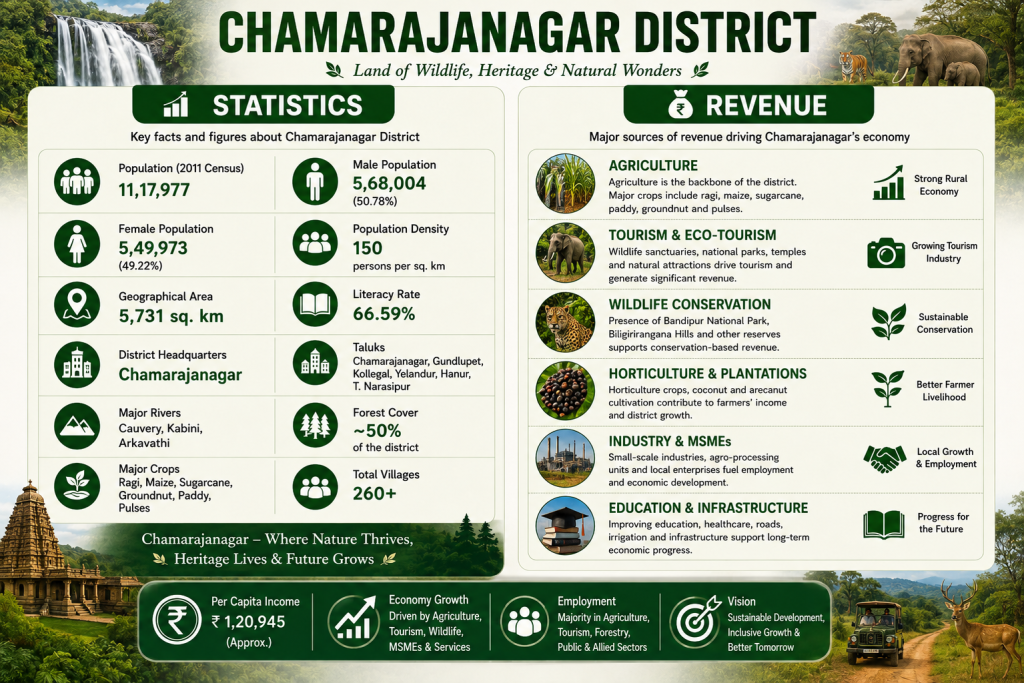
The image highlights the key statistics and revenue sources that drive the growth and development of Chamarajanagar district. With a geographical area of approximately 5,101 sq. km, a population of 10.2 lakh, a literacy rate of 61.43%, and five taluks, the district possesses a strong foundation for economic progress. Agriculture remains the backbone of the local economy, with major crops such as ragi, maize, sugarcane, paddy, and pulses supporting thousands of farming families. Tourism and eco-tourism contribute significantly through renowned destinations like Bandipur National Park, BRT Tiger Reserve, and Male Mahadeshwara Hills, attracting visitors from across India. The district’s extensive forest cover and wildlife resources also support conservation-based activities, while horticulture, plantations, small-scale industries, and MSMEs generate employment and income. Investments in education, healthcare, roads, and infrastructure continue to strengthen the district’s economic potential, making Chamarajanagar a region where natural resources, cultural heritage.